
With clubs in NJ, the Yankees and Giants kept their top affiliates close

When the new arrangements between Major League clubs and their affiliates become official, the Twins will have the closest Triple-A affiliate, perhaps in history, based on the shortest overland distance between their Target Field in Minneapolis and the Saints’ CHS Field in St. Paul.
In my recent study of MLB clubs’ distances to their affiliates, the mileage I used was from the driving routes offered between the ballparks on Google Maps. For consistency (and sanity), I went with the shortest distance shown if multiple routes were displayed in the results, but I didn’t dig down any further than that. To play with the routes by dragging the line to find the shortest distance via roads — and to do that 120 times — would have taken up too much time and wouldn’t have been foolproof. Someone would need to write an algorithm for that.
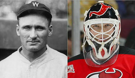
But Stew Thornley, a member of the Society For American Baseball Research who lives near the Twin Cities, drove the route between Target Field and CHS Field and measured it at 10.4 miles, shorter than the 12.5 that I listed. He then posted a question to the SABR discussion list: Is that the shortest distance between a team and its top farm club? He specifically wondered about the distances between the New York Giants and their Jersey City affiliate and the Yankees and the Newark Bears, noting that routes he was finding on Google Maps were in the 20-mile range, but figured it could be shorter than that.
So I set out to find out.
I began by getting Google’s results driving from the Droyer’s Point site of Roosevelt Stadium in Jersey City to the John T. Brush Stairway, which allowed fans to descend Coogan’s Bluff to reach the Polo Grounds in Upper Manhattan. Predictably, the fastest route took me up the New Jersey Turnpike and over the George Washington Bridge — a drive of 22.8 miles. So I dragged the route to take me through the Holland Tunnel and up the West Side Highway, and bingo: 16.6 miles.
Next up, measuring the distance between the old Yankee Stadium and the Newark location of the Bears’ Ruppert Stadium. Once again, the GWB was shown as the fastest route, at 21.6 miles. Forcing Google to measure via the Holland Tunnel dropped the distance to 18.3 miles.
Now it was time to confirm those distances in the car.
With my wife riding shotgun to take pictures, I plugged in the Society Hill development that now occupies Roosevelt Stadium’s land in Jersey City and we set out before noon on a weekday between Christmas and New Year’s Eve.
Roosevelt Stadium stood on the shores of Newark Bay from 1937-85 and primarily served as the home of the Jersey City Giants, the big club’s affiliate from 1937-50. Later tenants included the Jersey City Jerseys (the Reds’ Triple-A affiliate from 1960-61), the Jersey City Indians (Cleveland’s Double-A affiliate in ’77) and the Jersey City A’s (Oakland’s Double-A affiliate in ’78). Football and soccer games, boxing matches and concerts were also held there. After the stadium was torn down, the gated housing community was built, and that’s where we started the odometer — in the most Jersey way possible: By taking a jughandle to reverse our course on State Route 440.

From Society Hill, we headed north on 440, passing the Stadium Plaza shopping center that abuts the Society Hill property before sliding onto U.S. 1 & 9 and waving to the Wilson’s Carpet Paul Bunyan/Muffler Man seen in the opening credits of The Sopranos. Less than a mile later, we merged onto NJ 139, which would take us into the Holland Tunnel.
As we approached the tunnel entrance, we were pleased to see that the heated controversy over the placement of the Christmas decorations on the façade over the toll booths has been quelled by a much more appropriate positioning of the wreath and tree. (A second wreath that once hung over the “U” in “Tunnel” now appears to be over the entrance from the New York side.)

Emerging from the tunnel, we circled around to West St. and followed the Hudson River shoreline north for eight-and-a-half miles, exiting onto W. 158th St. just a half-mile from the stairway.
John T. Brush owned the Giants from 1902 to his death in 1912, and the following year the team built the steps that led from ticket booths up on Edgecombe Ave. down Coogan’s Bluff to the Polo Grounds. Edgecombe is wide enough that we were able to pull over and check the mileage. Total distance from Society Hill in Jersey City: 16.4 miles, just under Google’s figure.

The stairway, refurbished by New York City in 2013, is once again in use, but we didn’t get out of the car. Instead, I set a course for the old Yankee Stadium, just a mile-and-a-half drive away, but even shorter if exit ramps and one-way streets weren’t a factor.
We crossed the Harlem River on the Macombs Dam Bridge and turned onto 161st St., passing the new stadium. It occurred to me that had the Pinstripe Bowl not been canceled this year, we wouldn’t have been able to make this trip on the day we did — it would’ve been only a few hours before kickoff, the streets packed with football fans.

The Big Bat — it has its own location marker on Google Maps — is a smokestack erected in 1975 during the renovations that transformed Yankee Stadium from a classic (if colossal) ballpark built in 1923 to a 1970s concrete stadium. I never experienced the original stadium, so to me Yankee Stadium was always a 1970s building, not a 1920s one.
The Big Bat stood just outside the home-plate entrance and provided exhaust for the heating system that, according to a New York Times story published when it went up, allowed the team offices to be heated for the first time — 52 years after the ballpark opened. When they tore down the old stadium, they left the bat behind, and it now stands beside a stairway leading to and from an MTA station.

After noting the mileage on the odometer, we set out again, this time bound for Newark, to see just how many miles once separated Yankees and Bears, who were New York’s top affiliate from 1932-49. We headed back over the Macombs Dam Bridge, across 155th St. to Broadway, and followed that down to 133rd St. to once again pick up the Henry Hudson Parkway/West Side Highway/West St. route — one uninterrupted road, several names — that would take us back to the Holland Tunnel.
As we neared the cruise ship terminals and USS Intrepid Museum, where the expressway ends and traffic lights once again become a necessary nuisance, we passed under the sign designating this section of the West Side Highway as the Joe DiMaggio Highway. Though I knew the road had been renamed in DiMaggio’s honor following his death in 1999, the placement of the sign caught us by surprise, so no original photo; instead, here’s the Google Street View.

The winter sun in our faces through the windshield and a brisk December wind kicking up whitecaps on the Hudson River to our right, we headed south without any traffic drama and slid back into the Holland Tunnel. Emerging on the Jersey side, we followed U.S. 1 & 9 over the Pulaski Skyway. Named for General Casimir Pulaski, it opened in 1932 — five years before Roosevelt Stadium, six years after Ruppert Stadium — and is listed on the state and national registers of historic places. Its traffic jams are also historic, and I’ve rarely driven this viaduct.

But it does provide a pretty direct route from Jersey City over the Hackensack and Passaic rivers into Newark, and shortly after descending from the skyway to the Ironbound neighborhood, we exited onto Wilson Ave. and reached our end point, 18.4 miles from The Big Bat. Google had said it was 18.3 miles, but the true distance is probably 18 or 18.1 miles if you remove the entrance ramp we had to take to get from the bat onto the Macombs Dam Bridge.
Ruppert Stadium stood at this site until 1967, when it was demolished to make way for a Vita Food Products production plant. Though Vita is still around (since 1898!), it is no longer in Newark, but the site remains home to some food manufacturers.

Currently, there is nothing to mark this site as the former home of the Newark Bears or Newark Eagles of the Negro National League. A marker was installed at the corner of Avenue K and Wilson Ave. in 2007, but based on a review of Google Street View images, it seems to have come down between 2012 and ’15.
Not only is that sign gone, but a post at the corner with a stop sign, street signs for both K and Wilson avenues and one designating the block as Ruppert Stadium Plaza is also nowhere to be found. This particular corner seems to have served as overflow parking for idle or decommissioned Newark Police vehicles (across the street is the city’s Division of Motors in the Department of Engineering); perhaps the sign posts got in the way of maneuvering the cars and trucks into and out of that plot of land.

The discussion among SABR members about any affiliates that might have been closer than 10 miles to their parent clubs has died down, so unless someone uncovers a shorter distance, it appears the Twins and Saints will soon supplant the Giants of New York and of Jersey City as the closest known MLB and Triple-A clubs.